Reading the Sky: A Beginner's Guide to Weather for Paraglider Pilots
- Handre Fouche
- Mar 23
- 7 min read

Before your first proper flight, your instructor will look up at the sky, watch the grass move, hold up a wet finger, and make a decision that determines whether you fly today or not. It can look almost mystical at first. But it isn't magic — it's weather reading. And it's one of the most important skills you'll ever develop as a pilot.
The good news? You don't need a meteorology degree. You need to understand a handful of core ideas — and once they click, the sky starts making sense in a way that's genuinely fascinating.
It All Starts With Heat
Here's the simplest way to understand weather: the sun heats the ground, but it doesn't heat it evenly. A dark ploughed field absorbs heat faster than a lake. A rocky hillside warms up differently to a green valley. This uneven heating creates temperature differences in the air above — and temperature differences create pressure differences — and pressure differences create wind.
That one chain of events — uneven heating leads to pressure difference leads to wind — is the engine behind almost every weather phenomenon a paraglider pilot cares about. Keep that in mind as you read on, because it explains almost everything.
Stable vs Convective: The Two Kinds of Flying Days
One of the first things you'll learn to judge is whether a day is stable or convective — and the difference matters enormously.
On a stable day, the air is layered and calm. It doesn't want to mix. Flying tends to feel smooth and forgiving — ideal for beginners. On a convective day, the sun is heating the ground hard, warm air is rising in columns called thermals, and the atmosphere is active and mixing. Convective days can be exhilarating for experienced pilots, but they're unpredictable and demanding for beginners.
Cold, dense air generally means smoother, more forgiving flying. Hot, low-density air means more convection, more thermals, and more activity. Neither is inherently dangerous — but you need to know which one you're in.
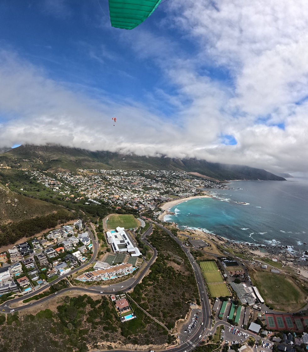
Learning to Read Clouds
Clouds are the atmosphere's way of showing you what's happening inside it. Once you know what to look for, they become one of your most useful tools as a pilot.
Puffy white cumulus clouds — the classic fair-weather clouds — are a sign that warm air is rising and thermals are active underneath them. The base of a cumulus cloud marks the point where rising warm air cools enough to condense into visible moisture. Where you see cumulus, there is likely lift below it.
Flat, grey stratus clouds tell a different story. They indicate a stable atmosphere with limited lift and sometimes poor visibility. Not a bad day to fly — but don't expect much soaring.
The clouds that demand your full attention are the ones that build rapidly upward — towering cumulus that grow taller as you watch them. These signal increasing instability and potential storms. When clouds are growing vertically, conditions are deteriorating. Land.
And then there's the sneaky one: a clear blue sky on a hot day. No clouds doesn't mean no thermals — it can actually mean strong, invisible thermals that are harder to read and more turbulent. Blue thermals, as pilots call them, can catch beginners off guard.
Ridge Lift: The Wind Goes Up
When wind hits a hillside or mountain, it has nowhere to go but up. That upward deflection creates a band of rising air on the windward side of the slope — and that rising air is what keeps a paraglider aloft when soaring.
Ridge lift is one of the most approachable forms of lift for beginner pilots because it's relatively smooth and predictable — as long as the wind stays within a reasonable range. But here's the thing new pilots need to understand: ridge lift can feel perfectly smooth right up until it isn't. If the wind increases, the turbulence on the lee side of the hill (the side sheltered from the wind) intensifies. Flying into the lee side — called flying into rotor — is one of the more serious mistakes a pilot can make.
The rule at Sky Safari is simple: know where the rotor is before you launch, and stay well away from it.
Thermals: Rising Air, Rising Excitement
A thermal is a column of warm air rising from a heated patch of ground. When you fly through the base of a thermal, your wing gets pushed upward. Circle tightly enough and you can ride that column of air thousands of metres into the sky — this is the foundation of cross-country paragliding.
But thermals aren't just lift. They're also surrounded by sink — air that's descending to replace the rising column. And the edges of a thermal can be turbulent, especially in the afternoon when the heating is strongest. This is why we say that thermals are lift plus turbulence. For beginner pilots, we seek out gentle, weak thermal conditions and build up gradually.
How do you find thermals? You learn to read the clues: patches of ground that heat up quickly (dark soil, rocky outcrops, car parks, dry fields), the base of forming cumulus clouds, birds circling without flapping, and — most practically — the feeling of the wing surging gently upward beneath you.
The Wind Is Not Your Speed
This is one of the most important concepts for new pilots to internalise, and it trips people up more than almost anything else.
A paraglider flies at its own airspeed — the speed of the wing through the air mass around it. The wind is simply the movement of that air mass. These are two different things. You can fly into a strong headwind and barely move over the ground while your airspeed is perfectly safe. You can fly with a tailwind and cover ground quickly while being dangerously close to stall.
What matters to your wing is airspeed — not what the ground looks like underneath you. New pilots sometimes panic when they seem to be flying backwards over the ground in a strong headwind. They're fine — their wing is flying normally. The trap is the opposite: assuming you're safe because you're moving fast over the ground, when actually you have a tailwind and your airspeed is dangerously low.
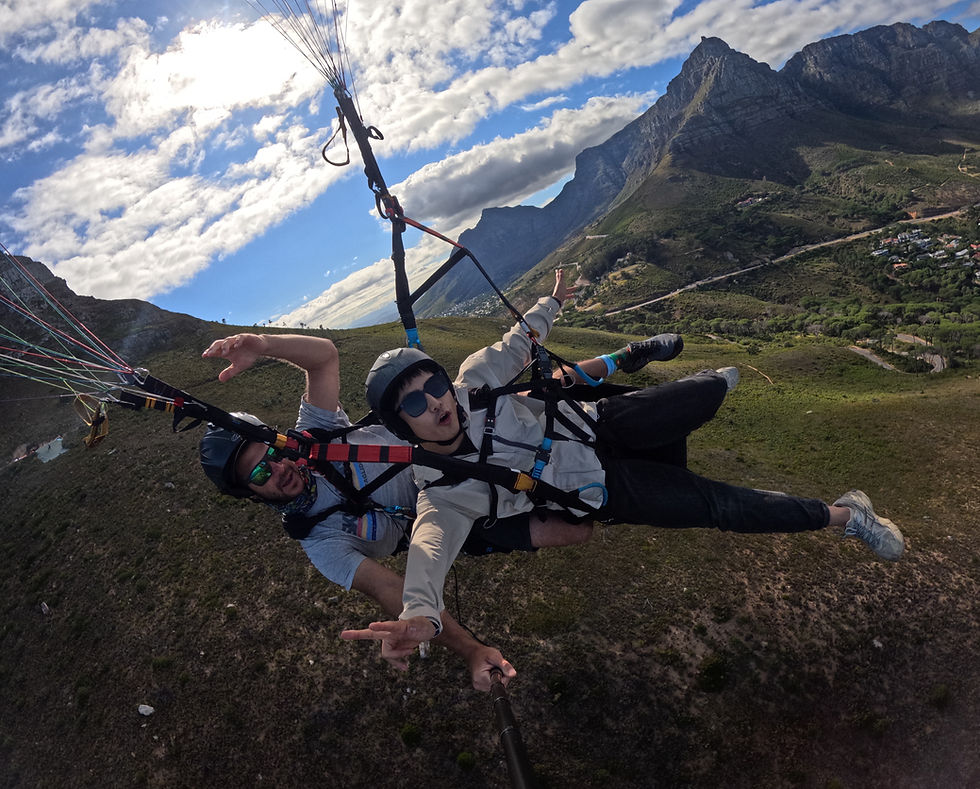
Cape Town and the Garden Route: Local Weather You Need to Know
If you're flying with Sky Safari, you'll spend time in two of the most beautiful — and meteorologically interesting — flying regions in South Africa.
The Cape Doctor is Cape Town's famous summer south-easterly wind. It's reliable, often strong, and a part of life on the Cape Peninsula. For pilots, it means planning your flights for the morning before the wind builds, paying close attention to gusts near terrain, and respecting the fact that conditions change quickly as the SE picks up through the day.
The sea breeze on the South Coast of the Garden Route typically strengthens from late morning through the afternoon. What starts as a gentle morning breeze can become a robust wind by early afternoon. Don't assume the conditions you launched in will stay the same — check in with your instructor and always know your landing options.
The berg wind is a fascinating and somewhat deceptive phenomenon. It comes off the land, often feels smooth and warm at first, and can seem like a perfect flying day. But berg winds can strengthen rapidly, end abruptly, and bring gusty, unstable conditions — especially near mountains. We treat berg wind days with extra caution.
Winter cold fronts in the Western Cape bring fast-moving changes — wind increases quickly, direction shifts, and visibility can drop. Unless conditions are clearly stable and settled, a front approaching is a no-fly day.
And thunderstorms? Non-negotiable. No exceptions. Gust fronts, wind shear, and severe turbulence associated with storms are beyond the limits of any paraglider. If there's a thunderstorm in the area, you're on the ground — full stop.
The Questions to Ask Before Every Flight
Here at Sky Safari, we have a pre-flight weather checklist that every pilot runs through before launching. As a beginner, your instructor will walk you through it every day. Over time, it becomes second nature. These are the questions:
What is the wind doing at launch — and at the landing field?
What is the gust spread? Are gusts much higher than the average?
Is it a stable or convective day?
Is there any front or storm risk in the next few hours?
Where is the rotor likely to be at this site?
Do I have safe landing options for the full duration of the flight?
That last one is worth repeating on its own: do you have safe landing options for the full duration of the flight? A safe flight isn't just about the conditions right now — it's about whether your options stay safe for the whole time you're in the air.
The Rule That Overrides Everything
We'll leave you with the single most important weather rule in paragliding, one that experienced pilots carry with them on every flight:
If you cannot explain what the air will do in the next hour, do not launch.
That's not timidity — that's wisdom. The best pilots in the world are the ones who've learned to say "not today" without ego getting in the way. Weather understanding isn't just about knowing when to fly. It's about knowing when not to.
On Sky Safari's 12-day training course, weather theory is taught live on the hill — using the actual conditions of the day as the lesson. You'll learn to read the sky not from a textbook, but from standing on a launch site with your instructor, watching the grass and the clouds and the windsock together. It's one of the most valuable parts of the whole course.
Interested in learning to fly? Visit the training page or send us a WhatsApp on +27 72 252 1678 to find out more about our next course.


Comments